All posts by admin

Marine Pollution Bulletin Report: Lethal and sublethal effects of dredging on reef corals by Rolf P.M. Bak

Marine Pollution Bulletin, Volume 9, Issue 1, January 1978, Pages 14–16
Caribbean Marine Biological Institute (Carmabi), Piscaderabaai, Curaçao, Netherlands Antilles Netherlands

http://dx.doi.org/10.1016/0025-326X(78)90275-8,

The full article is only available by paying $39.95, but the extract ends with one very strong statement for those who think that the sediment from storms compares to the avoidable impacts of dredging on corals. DV

Purchase $39.95

Abstract

Effects of dredging on a coral reef are described. Under water light values at a depth of 12–13 m were reduced from about 30% to less than 1% surface illumination. Colonies of coral species which are inefficient sediment rejectors (Porites astreoides) lost their zooxanthellae and died. Calcification rates in Madracis mirabilis and Agaricia agaricites were observed to decrease by 33%. The period of suppressed calcification exceeds that of environmental disturbance.

Science Network: Offshore dredging severely impacts coral reefs

http://www.sciencewa.net.au/topics/fisheries-a-water/item/1684-offshore-dredging-severely-impacts-coral-reefs.html
Thursday, 13 September 2012 06:00

Murky coral
The study found that sediment accumulation on coral tissue was a “strong and consistent cause of tissue mortality” and resulted in the death of whole coral fragments over prolonged periods.
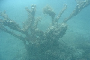
Murky_coral

Image: Dan Derret RESEARCH by the Australian Institute of Marine Science has discovered that proposed dredging works along the WA coast could severely impact certain coral species found in local waters.

Scientists from the Institute along with the Australian Research Centre of Excellence conducted laboratory tests to develop lethal and sub-lethal benchmarks for coral exposed to dredging-generated sediments related to offshore developments.

The researchers tested two species of coral found in offshore locations to six levels of total suspended solids for 16 weeks, including a four week recovery period.

They tested the horizontal foliaceous species Montipora Aequituberculata and the upright branching species Acropora Millepora, both of which are found along WA’s coast.

Montipora Aequituberculata proved to be more susceptible as after 12 weeks all coral tissue under the sediment had died, exposing white coral skeleton.

Australian Institute of Marine Science senior principal research scientist Ross Jones says the sediment can affect coral by impacting their ability to feed as well as settling on the coral’s surface, causing it to expend energy cleaning itself.

“It can also attenuate light—light attenuation is a key thing because a lot of these habitats are primary producer habitats so the corals and sea life need light to photosynthesise and light is attenuated by the sediments,” Dr Jones says.

“It is like having permanently cloudy weather all the time, so it has the potential to have an effect on the marine environment.”

The study found that sediment accumulation on coral tissue was a “strong and consistent cause of tissue mortality” and resulted in the death of whole coral fragments over prolonged periods.

“What the study showed was that one species which was generally a flat plate-like coral was affected more so that the branching Acropora species because the sediment began to pile up on the coral,” Dr Jones says.

“That happened to an extent and rate at which it couldn’t clear itself, so it gradually became buried because the sedimentation rate was faster than its ability to clear itself.”

Woodside Energy funded the study and was cited as the operator of the proposed $30 billion Browse liquefied natural gas development at James Price Point, north of Broome.

Dr Jones says Woodside commissioned the study because it was investigating the effects of dredging at Browse.

“This study was initially commissioned by Woodside to try and come up with some numbers to build an environmental assessment of the project,” Dr Jones says.

He says this report is only a small amount of the research that will be conducted in the next few years into what sediment does to corals and other marine life in response to the proposed dredging.

Key West Harbor Reconnaissance Report by US Army Corp of Engineers

key_west_harbor_excerpt

Perhaps most importantly, this brief 7-page report ends with the following: DV

Under the Endangered Species Act (ESA) of 1973; the threatened coral Acropora cervicornis (staghorn coral) and Acropora palmata (elkhorn coral) could be located adjacent to the channel in the areas proposed for expansion (Figure 2) as this area is designated as critical habitat for these species. While it is possible to relocate the actual colonies of coral, the critical habitat would be permanently removed. It is highly likely that the removal of several acres of occupied designated critical habitat (habitat where the species has been shown to be able to flourish under baseline conditions) could be considered an adverse modification of critical habitat under Section 7 of the ESA. This would be Jacksonville District’s first adverse modification of critical habitat determination in the last 15 years. It is also unknown what reasonable and prudent alternatives and measures National Marine Fisheries Service (NMFS) would include in a biological opinion to avoid the project adversely modifying designated critical habitat, as required under Section 7 of the Act. It is expected that resource agencies would oppose any channel modifications outside the existing footprint.

Academia.Edu: Dredging and shipping impacts on southeast Florida coral reefs by Brian K. Walker, et. al.

http://academia.edu/1258184/Dredging_and_shipping_impacts_on_southeast_Florida_coral_reefs
Proceedings of the 12th International Coral Reef Symposium, Cairns, Australia, 9-13 July 201219A Human impacts on coral reefs: general session

Authors: Brian K. Walker 1, David S. Gilliam 1, Richard E. Dodge 1, Joanna Walczak²
1 National Coral Reef Institute, Nova Southeastern University, Dania Beach, FL, USA
² Florida Department of Environmental Protection, Miami, FL, USA
Corresponding author: walkerb@nova.edu

Abstract.
Many coastal regions have experienced extensive population growth during the last century. Commonly, this growth has led to port development and expansion as well as increased vessel activity which can have detrimental effects on coral reef ecosystems. In southeast Florida, three major ports built in the late 1920’s along 112 km of coastline occur in close proximity to a shallow coral reef ecosystem. Recent habitat mapping data were analyzed in GIS to quantify the type and area of coral reef habitats impacted by port and shipping activities. Impact areas were adjusted by impact severity: 100% of dredge and burial areas, 75% of grounding and anchoring areas, and 15% of areas in present anchorage. Estimates of recent local stony coral density and cover data were used to quantify affected corals and live cover. After adjusting for impact severity,312.5 hectares (ha) of impacted coral reef habitats were identified. Burial by dredge material accounted for 175.8 ha. Dredging of port inlet channels accounted for 84.5 ha of reef removal. And 47.6 ha were impacted from a large ship anchorage. Although the full extent of all ship groundings and anchor drags associated with the ports is unknown, the measured extents of these events totaled 6 ha. Based on the adjusted impact areas,over 8.1 million corals covering over 11.7 ha of live cover were impacted. Burial impacts were the greatest. The planned expansion of two of the ports would remove an additional approximate 9.95 ha of coral reef habitat.Ongoing marine spatial planning efforts are evaluating the placement of large ship anchorages in an effort reduce future impacts from ship anchoring. However, increasing populations and shipping needs will likely continue to be prioritized over protection of these valuable natural resources.

Full text and tables at:
Walker_et_al_ICRS2012_Proceedings_SEFL_Shipping_Impacts_Revision

Increased Stray Gas Abundance in a Subset of Drinking Water Wells Near Marcellas Shale Gas Extraction

StrayGasStudy

Robert B. Jacksona,b,1, Avner Vengosha, Thomas H. Darraha, Nathaniel R. Warnera, Adrian Downa,b, Robert J. Poredac,
Stephen G. Osbornd, Kaiguang Zhaoa,b, and Jonathan D. Karra,b
aDivision of Earth and Ocean Sciences, Nicholas School of the Environment and
bCenter on Global Change, Duke University, Durham, NC 27708;
cDepartment of Earth and Environmental Sciences, University of Rochester, Rochester, NY 14627; and
dGeological Sciences Department, California State Polytechnic University, Pomona, CA 91768

Edited by Susan E. Trumbore, Max Planck Institute for Biogeochemistry, Jena, Germany, and approved June 3, 2013 (received for review December 17, 2012)

Horizontal drilling and hydraulic fracturing are transforming energy production, but their potential environmental effects remain controversial. We analyzed 141 drinking waterwells across the Appalachian Plateaus physiographic province of northeastern Pennsylvania, examining natural gas concentrations and isotopic signatures with proximity to shale gas wells. Methane was detected in 82% of drinking water samples, with average concentrations six times higher for homes <1 km from natural gas wells (P = 0.0006). Ethane was 23 times higher in homes <1 km from gas wells (P =0.0013); propane was detected in 10 water wells, all within approximately 1 km distance (P = 0.01). Of three factors previously proposed to influence gas concentrations in shallow groundwater (distances to gas wells, valley bottoms, and the Appalachian Structural Front, a proxy for tectonic deformation), distance to gas wells was highly significant for methane concentrations (P = 0.007; multiple regression), whereas distances to valley bottoms and the Appalachian Structural Front were not significant (P = 0.27 and P = 0.11, respectively). Distance to gas wells was also the mostsignificant factor for Pearson and Spearman correlation analyses (P < 0.01). For ethane concentrations, distance to gas wells was the only statistically significant factor (P < 0.005). Isotopic signatures (δ13C-CH4, δ13C-C2H6, and δ2H-CH4), hydrocarbon ratios (methane to ethane and propane), and the ratio of the noble gas 4He to CH4in groundwater were characteristic of a thermally postmature Marcellus-like source in some cases. Overall, our data suggest that some homeowners living <1 km from gas wells have drinking water contaminated with stray gases.