Volunteers use airborne patrols, satellite photos to spot oil spills along Louisiana coast
The Lens
By Bob Marshall, Staff writer 8 HOURS AGO
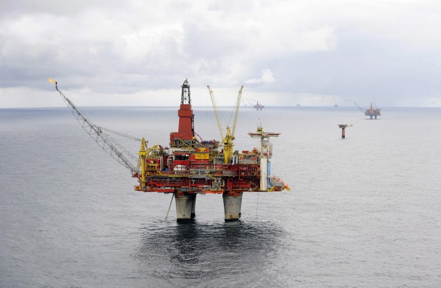
Jonathan Henderson was shouting to be heard over the engine noise in the small plane as it circled above an oil rig just off the Louisiana coast. A ribbon of colored water extended from the rig for about 100 yards, and Henderson had asked the pilot for a closer look.
“Right there, that’s sheen,” Henderson yelled. “In fact, rainbow sheen tells us it’s oil, and it’s probably coming from that platform.”
He snapped a few pictures and jotted on a notepad.
“When we get back, I’ll make a report,” says Henderson of the Gulf Restoration Network, an environmental group based in New Orleans.
In the last three years, after 200 surveys by air, boat and foot, Henderson has made hundreds of oil pollution reports as part of the Gulf Monitoring Consortium. In what has developed into an almost 24/7 effort, members use private boats, planes and even satellite imagery to spot and evaluate insults to Louisiana’s coastal environment – all at no cost to taxpayers.
“They’re operating pretty much on the honor system out there. The Coast Guard has limited resources. If the amount is small, they are less likely to go out and take a look.”
-David Manthos, SkyTruth
Their effort would be noteworthy solely for its altruistic nature. But what may be more remarkable is that they are the only ones doing this work.
No state or federal agency has cops regularly walking this beat. Instead, state and federal governments, which collect billions in royalties from the permit holders each year, rely on companies to turn themselves in for violating environmental law or the terms of their permits.
“We don’t have people whose job it is to go out looking for spills; we rely on people to report things,” said Gregory Langley, spokesman for the Louisiana Department of Environmental Quality, which says its mission is to protect public health, safety and welfare “while considering sound policies regarding employment and economic development.
”
The state Department of Natural Resources has 12 inspectors who check wells along the coast for compliance with regulations, a spokesman said. Though those checks are conducted without notice, the industry is so large that the department’s goal is to inspect each one every three years.
REPORTING REQUIREMENTS VARY
The federal Clean Water Act literally requires anyone who drops anything into the water that creates a sheen of any size, or falls as a solid to the bottom, to report it to the National Response Center, which is operated by the U.S. Coast Guard.
“That’s our gold standard because that’s what the law says,” said Michael Anderson of the Coast Guard’s Gulf Coast Incident Management Team, which is based in New Orleans.
If oil spills onto land, however, state law applies. Louisiana says permit holders only have to make a report if the amount spilled reaches a “reportable quantity,” designated as one barrel, or 42 gallons.
“Basically they get to pollute for free to a certain level,” said Andy Zellinger, an analyst for the Louisiana Bucket Brigade, a member of the monitoring group.
When the National Response Center receives a report, it notifies the proper state and federal agencies.
Typically, state agencies relay the information to a local first responder, which could be the State Police or sheriffs’ offices, which conduct on-site inspections. But if the polluter thinks there’s a risk to human health or a serious threat to the environment, the company must immediately notify the Coast Guard or the state agency as well.
SPILLS ROUTINE, UNDER-REPORTING COMMON
Records show there’s a lot to report each year in coastal Louisiana.
The Louisiana Oil Spill Coordinator’s Office estimates that about 330,000 barrels, 20 percent of all the oil spilled in the nation each year, leaks from Louisiana facilities. The agency says that amount comes from 1,500 reports each year – but that’s far lower than Coast Guard records show.
Anderson said his office responded to 23,371 reports in Louisiana over the last five years. Even taking out the 5,781 from 2010, the year of the Deepwater Horizon spill, that averages about 4,400 per year.
Most of that pollution takes place in the coastal zone – the interior wetlands and open Gulf – which is where most of the 290,000 oil and gas wells permitted over the years are located, according to a database at the state Department of Natural Resources.
The concentration of the industry in Louisiana means more spills are likely to happen here, but Henderson said that until the Deepwater Horizon disaster, even environmental groups were not fully aware of how routine spills are.
“Many times if we don’t make a report, the company won’t – and I can say that because there are many times when they make a report after we do.”
-Jonathan Henderson, Gulf Restoration Network
It was during the months after the spill, as Henderson made almost daily flights to survey where oil was headed, that he realized there was a less dramatic but more widespread and persistent problem.
“I’d be going over the marsh to check on what was happening in the open Gulf and I’d look down and see sheen in places where we knew BP’s oil hadn’t reached – or at least hadn’t reached yet,” Henderson said. “That’s when I thought, ‘Hey, who’s keeping an eye on this?’
“And the answer to that, of course, is ‘No one.’ So we had to do something about that.”
Henderson began to make regular flights over the coast, becoming expert at recording the types of data that help the Coast Guard respond.
Meanwhile, other environmental groups were homing in on the same issue, including the Louisiana Bucket Brigade, the Lower Mississippi Riverkeeper and SouthWings, a group of private pilots who donate their time and aircraft for environmental monitoring.
Those groups often got help from SkyTruth, a Washington, D.C.-based organization that uses satellite photographs to analyze National Response Center reports and find unreported trouble spots nationwide.
Those environmental groups formed the Gulf Monitoring Consortium in 2011 to share information and plan events.
250,000
Gallons spilled in one year, according to companies
1.5-2.5 million
SkyTruth’s estimate
When a member of the consortium makes a report to the National Response Center, SkyTruth often quickly finds the location on a satellite image. Using a calculation accepted by oil spill experts, its analysis typically indicates that a spill is 10 times larger than the company’s report, said David Manthos of SkyTruth.
According to a consortium report, the companies that filed 2,093 spill reports from October 2010 through September 2011 estimated the total pollution at about 250,000 gallons. The SkyTruth evaluation put the figure between 1.5 and 2.2 million gallons.
“We have problems with non-reporting, but also with under-reporting,” Manthos said. “They’re operating pretty much on the honor system out there. The Coast Guard has limited resources. If the amount is small, they are less likely to go out and take a look.
“That’s where we try to focus our efforts.”
MAPS SHOW TROUBLE SPOTS
The consortium’s efforts have led to several regularly-updated websites that chart the widespread nature and frequency of oil spills in Louisiana’s coastal zone and the Gulf of Mexico.
The Louisiana Bucket Brigade’s iWitness Pollution Map and SkyTruth’s national Alerts Map show a series of red dots spreading across the Louisiana coast like a rash.
By clicking on the dots visitors see the NRC record, including the polluter’s original estimate of the spill and SkyTruth’s evaluation.
“Everything is right there,” said the Bucket Brigade’s Zellinger. “You don’t have to wade through the NRC site; these interactive maps take you right to the history of that report in your area, including what we believe is the real size of that release.”
The consortium has been especially effective in locating trouble spots during the tropical storm season. Henderson and Gulf Monitoring Consortium colleagues were in the air and on the water as soon as conditions were safe after Hurricane Isaac in 2012.
Their report, “Gulf Coast Coal and Petrochemical Industries Still Not Storm Ready,” catalogued the 341,044 gallons of oil, chemicals and untreated wastewater that were reported to have been leaked into wetlands. The group said the actual amount spilled likely was much greater because only 20 percent of the 139 reports included size estimates.
“HOW MANY SPILLS ARE WE MISSING?”
No one knows the efficacy of the monitoring alliance better than Henderson, who estimates he has taken more than 75 monitoring flights since attention turned from the Deepwater Horizon to the rest of the Gulf and the coastal wetlands in 2011.
Now 38, Henderson still makes each flight with the enthusiasm of a rookie because he believes the work is making a difference.
“Many times if we don’t make a report, the company won’t – and I can say that because there are many times when they make a report after we do,” he said.
“Sure, there’s a logistical problem for the companies. We’re talking about thousands of facilities spread out over tens of thousands of square miles. Most of those don’t have personnel on them, and most of them are not serviced on a daily basis. So sometimes, I just beat them to the spill.”
He continued, “But then you have to ask, ‘How many spills are we missing? How much oil has been leaking into the wetlands that nobody knows about because they don’t find it until days after it’s begun?'”
And while proud of the job he and his peers are doing, he resents that nonprofits must “beg for money to do a job that government should be doing.”
Henderson pointed to a similar independent monitoring program that has been in place in Alaska since the Exxon Valdez spill in 1989. That program is funded by a fee on the users of the Alyeska Pipeline.
The independent monitoring is done by the Prince William Sound Regional Citizens Advisory Council, established by the federal Oil Pollution Act of 1990.
“Those councils were established only for Alaska. The Gulf was left out,” Henderson said. “I think it’s time for Congress to take a look at what we’re finding here – at the size of the industry and the risk to this valuable ecosystem – and do the same thing here.”
In the meantime he said, he’ll keep flying and looking.
Special thanks to Richard Charter
